

Lot n° 55
Estimation :
50 - 80
EUR
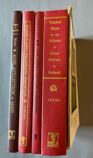
(Cartography) - 4 works - Lot 55
(Cartography) - 4 works
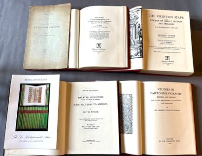
- CHUBB (Thomas). *The Printed Maps in the Atlases of Great Britain and Ireland: A Bibliography, 1579–1870*. London, 1927 (Reprint, 2004). 8vo, [1 f] (frontispiece), XVII, 479 pp., publisher’s cloth. Numerous off-text reproductions.
- WINSOR (Justin). The Kohl Collection (now in the Library of Congress) of Maps Relating to America. With an index by Philip Lee Phillips. Washington, 1904 (reprint, 2002). 8vo, [1 f], 189 pp, publisher’s cloth. "A total of 474 early maps of America are described, many with useful annotations and comments."
- FORDHAM (Herbert George). Studies in British and French Carto-Bibliography and the Bibliography of Itineraries and Road Books. Oxford, Clarendon Press, 1914 (Reprint, 2004). In-8, [1 f], VII pp, [1 f], 180 pp, publisher’s red cloth. 4 illustrations, including the frontispiece and a separate plate.
FORDHAM (Herbert George). *Some Notable Surveyors & Map-Makers of the Sixteenth, Seventeenth & Eighteenth Centuries and their Work*. A Study in the History of Cartography. Cambridge, 1929 (Reprint, 2005). In-8, XII, 99 pp., publisher’s red cloth. 9 illustrations, including the frontispiece and 3 separate plates.
Included are 2 booklets:
- The La Rochefoucauld Atlas, sold at auction in 1994.
- MARCEL (Gabriel). The Origins of the Map of Spain. Paris, 1899.
My orders
Sale information
Sales conditions
Return to catalogue